Smart Cities

Digitize your City
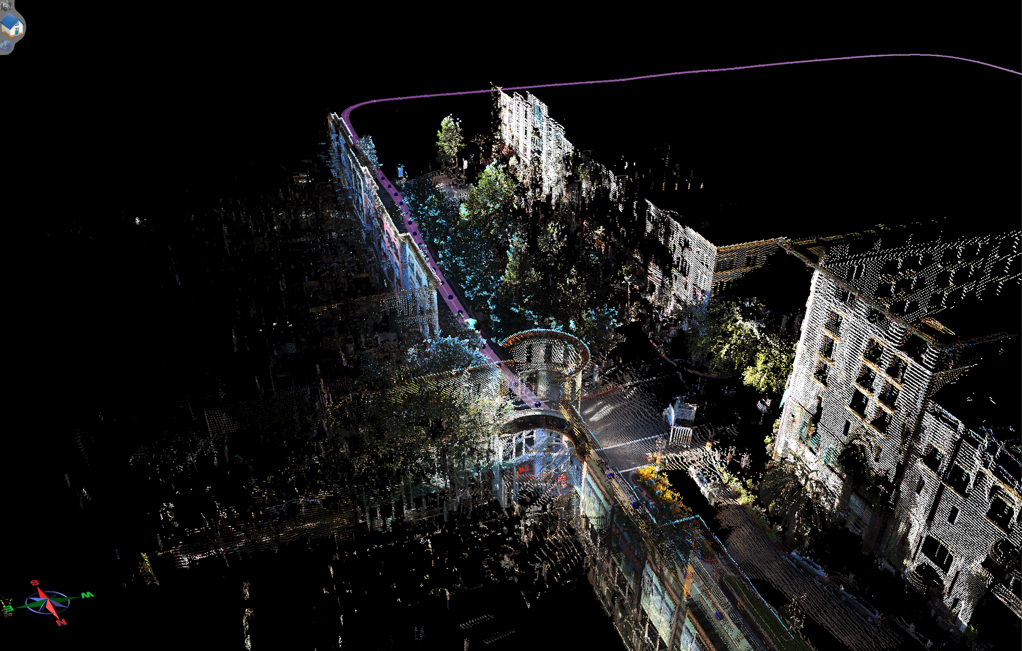
Smart cities use a combination of the internet of things (IoT) devices, software solutions, user interfaces (UI), and communication networks. However, they rely first and foremost on the IoT. The IoT is a network of connected devices — such as vehicles, sensors or home appliances — that can communicate and exchange data. Data collected and delivered by the IoT sensors and devices are stored in the cloud or on servers. The connection of these devices and use of data analytics (DA), facilitates the convergence of the physical and digital city elements, thus improving both public and private sector efficiency, enabling economic benefits and improving citizen’s lives. One of the keys to success is first digitizing your city- taking the physically known and digitizing it. MCS does this using high density Lidar and imagery to collect spatially known references (up to and including survey grade) and digitizing them for our clients. Having this reference allows municipalities to plan and build out their smart cities based on true references.
Smart City Cont.
Smart cities are more than a trend–they’re the wave of the future because the world is becoming more urban, with 60% of the population expected to live in cities by 2050. Across the globe, smart city technology spending reached $80 billion in 2016, and is expected to grow to $135 billion by 2021, according to a report from the International Data Corporation (IDC). Cities are digitally transforming to improve environmental, financial, and social aspects of urban life. The IDC defines smart city development as the use of smart initiatives combined to leverage technology investments across an entire city, with common platforms increasing efficiency, data being shared across systems, and IT investments tied to smart missions
What is a Smart City
There is a range of definitions of a smart city, but the consensus is that smart cities utilize IoT sensors, actuators, and technology to connect components across the city. This connects every layer of a city – from the air, to the street, to underground. When you can derive and utilize data from everything that is connected, you have a smart city. These cities improve the lives of citizens and improve communication between citizens and the government. Some items a smart city can improve include; identifying inner city traffic, available parking spots, road construction.
Pre-Plan using a virtual environment
With our virtual environments, we bring pre-planning and decision making from the field to the desktop. After we map your proposed locations, we can create real-time environments to place 3D BIM objects. By doing this, your planning team or approving entity can see what the structure would look like in the current environment. If the location does not work, no problem! No revisits to the field are required. We can move the structure in our virtual environment to the desired location for review as long as the proposed area was driven beforehand.


Pre-Plan using a virtual environment
Parks and Recreation
Monitor Parks and recreaction areas made easy. By ustilizing our methods we are able to bring the work to your desktop. Monitor the health of plants and vegitation, asphalt, concrete and structure conditions all at the tip of your fingers using our high-density street level and aerial uav mapping.
Creek and Trail Corridor Mapping
Creeks – Corridor mapping with high-density imagery whether street level or aerial uav all help to facilitate the process of maintaining these areas for potential flooding or decline at a lower cost and higher frequency.
Trails – Using a combination of Street and Aerial UAV imagery allows governing agencies to monitor these areas more frequently at less cost. Keeping Tabs on trails that need repaving, the health of plants and trees, conditions of park structures, all made easy and brought to your desktop.