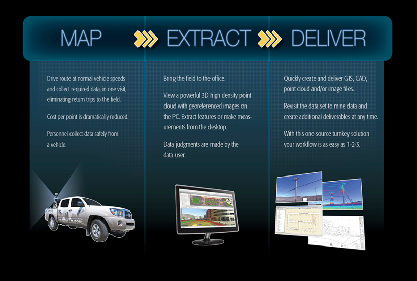
Mobile Mapping
We are taking the simple process of data (field) collection, normally done with personnel on the ground in the field and replacing them using Survey and Mapping Technologies that have been around for a very Long time. Using these Tried and Tested Survey Technologies in new innovative ways we can 10X our clients Feilding and Engineering By:
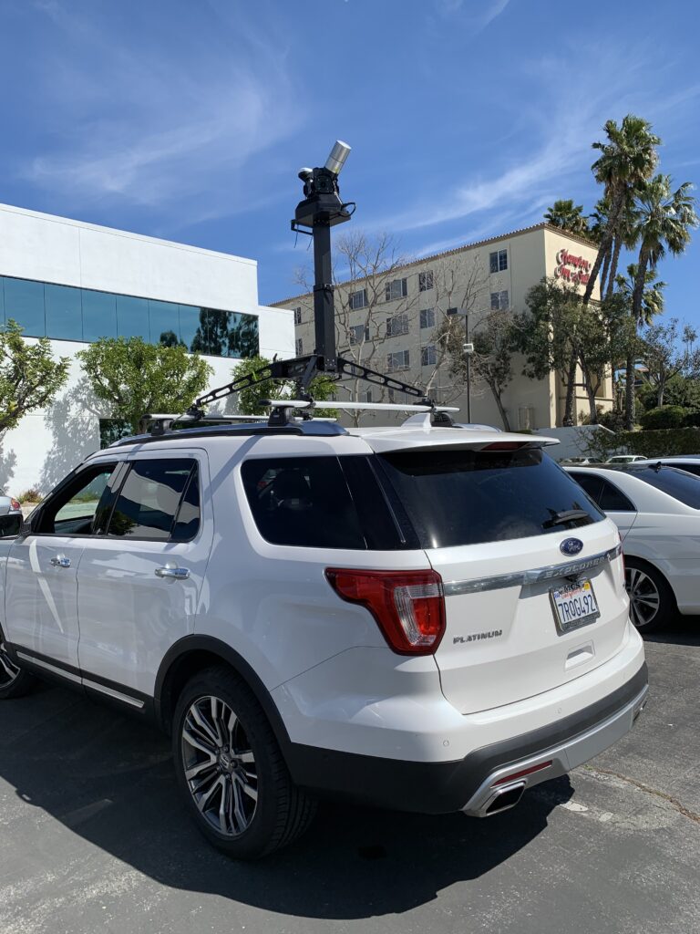
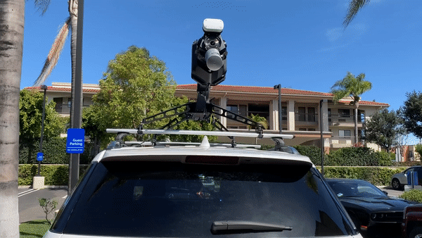
- Using Mobile & Aerial Lidar we can collect data at a very high rate in most cases as fast as you can drive
- Reducing the amount of human interaction in the field increases reliability and accuracy
- We have many custom scripts we have written, along with various software Company partnerships that have enabled us to build automation into our process
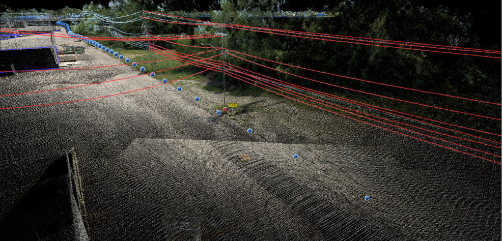
- Using automation we can semi-automatically and automatically extract datasets that were captured in the field from our Lidar unit, exporting the data directly into spatial environments like AutoCad, ESRI, and Spida
- For Utility Poles we can export our data in Mass directly into Pole Loading Softwares like SPIDA