Engineering

Now Partnering With Taro Communications
Our commitment to excellence is reflected in our superior services across GIS, design and drafting, project management, and construction. No challenge is too great for us to overcome, as we harness the expertise of the most qualified professionals in each domain. At Taro Communications, we pride ourselves on delivering comprehensive solutions that not only meet but exceed the expectations of our customers. Join us in the pursuit of cutting-edge connectivity solutions and experience the Taro Advantage that sets us apart in the world of telecommunications.
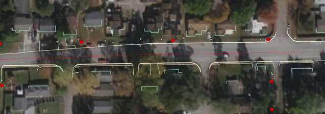
High Level Design (HLD)
For HLD design, we deploy mobile mapping units to gather the latest information in the field. Utilizing this technology, it allows us to gather the data very quickly that is needed for high level geospatial design.
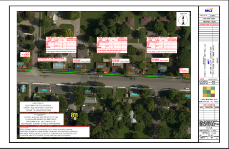
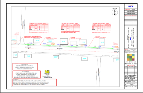
Low Level Design (LLD)
The data that are gathered with our high density lidar and imagery scanners allow us to do extraction for design, engineering, and to produce construction-grade drawings.
What’s different about our methods? These methods are able to reduce costs and increase velocity on our projects. In addition, these methods are able to decrease labor resources, thereby reducing the need for vehicles and equipment. By default, this helps reduce the carbon footprint on our customers’ projects.