Drones
Drones Services
MCS is a CA Silicon Valley-based company that offers a variety of services related to drones. We specialize in aerial surveys, pole utility inspections, Tower Inspections, Cell Site, MicroCell, Building, and Construction Site Inspections. MCS received its Part 107 certificate commercially in Sept. 2016. John, COO has been flying drones as a hobby for several years. He believes so much good can come from a drone this technology when used within FAA guidelines. Along with our Class A Contractors license, years of project management experience, we offer a wide range of services for drone projects.
Google Street View
John Lead a Global Program for Street View Launching projects in 3 countries and getting approval to fly in another 7 countries.
2019 – MCS worked with CAL-OES on the Creek Fire to test the use of Aerial 2d Ortho and Street Level imagery. The ortho imagery provides quick assessment ability to assess areas affected. John came up with an innovative solution and our team at MCS executed the idea an presented a much safer. more productive and stream-lined method for post disaster assessments.
2018 – John responded and supported crisis response efforts in the Philippines during the Mayon Volcano Eruption, Florida after Hurricane Michael, and after the fires in California.
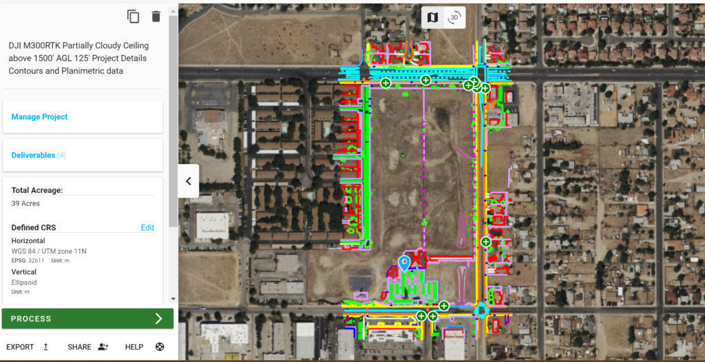
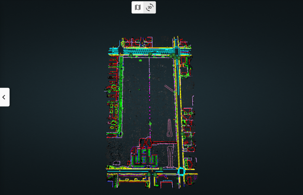
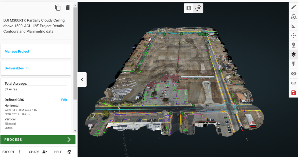
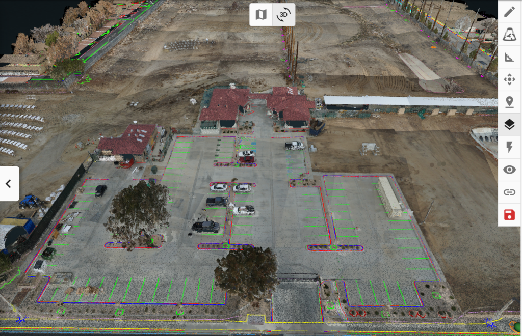
Photogrammetry
With photogrammetry, the drone can collect high- resolution photographs covering an area of almost any size. Those photos can then be collectively pieced together to create a detail- and data-rich portrait of the site or object being surveyed or analyzed.
Instead of just focusing on a single point, photogrammetry uses the overlapping images to create a detailed 3D map of the world; and instead of just displaying elevation data, photogrammetry also collects texture, shape, and color information for every point on the map – leading to a high-definition 3D reconstruction. A drone system that uses photogrammetry is very useful for capturing 3D and 2D images. It can map large areas and collect data from multiple vantage points. It can get close and capture images, like inspecting a cell phone tower without having to send a worker up there.
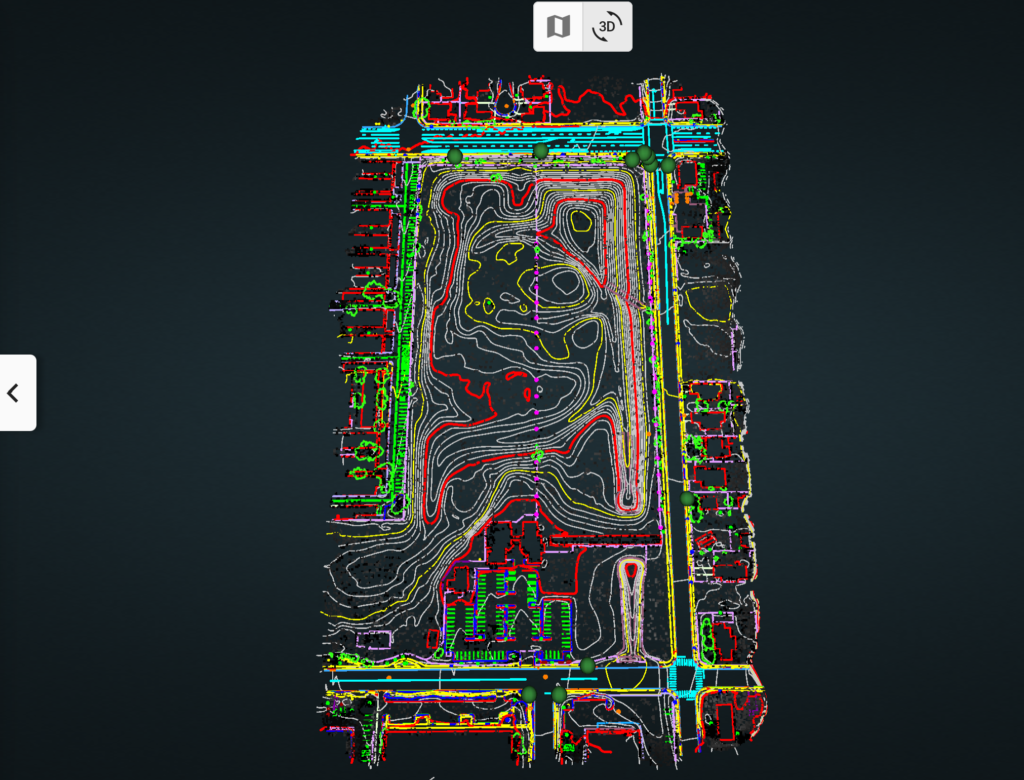
LiDAR
LiDAR, which stands for light detection and ranging, has been around for decades. However, it’s only recently been widely used over the last several years outside of the Surveying industry. A LiDAR sensor sends laser pulses in different directions and then determine(s) the exact time it takes for the beams to return. It also uses an algorithm to determine the intensity of the light. By measuring the intensity and timing, a LiDAR sensor can provide near-instantaneous, highly accurate readings of terrain and points on the ground. Repeated millions of times, the process can generate an incredibly data- rich point cloud.
In general, LiDAR can produce higher resolution, more accurate scans than photogrammetry can generally achieve. Indeed, LiDAR excels in use-cases that would confound traditional photogrammetry or human operators:
- Scanning terrain populated with vegetation and brush
- Scanning small, narrow, otherwise hard to see objects (like power lines)
- Working in poor lighting With LiDAR, operations can:
- Create a highly detailed topography (one- foot contours) that can effectively penetrate through vegetation to see the ground underneath, which is not possible through almost any other
- Focus on the vegetation and classify areas of high, medium, or low
SERVICES
COMMERCIAL REAL ESTATE
Aerial Photography
Construction Progress
Site Survey
Survey
Training
INDUSTRIAL SOLUTIONS
- Mapping and Photogrammetry
- Lidar
- Survey
- Site Survey
- Aerial GIS
- Asset Inspections
- Pole Line Inspections
- Tower Inspections
- Cell Site Inspections
- Micro Cell Inspections
- Building Inspections
- Training
- Emergency/disaster response
- Training
Sample Project Heliogen Alternative to Solar Energy